Moving to Pasadena for work in Downtown LA or the studios and wondering where you’ll actually enjoy living, and how long your commute will take most days? You are not alone. Los Angeles traffic is real, and neighborhood fit matters just as much as the drive. This guide compares Pasadena’s core areas by commute ranges and lifestyle touchpoints, then shows you how to read drive and transit maps so you can make a confident decision. Let’s dive in.
How to read commute maps
Commute times in greater LA vary by time of day and incidents. Expect ranges rather than a fixed number. Regional congestion patterns consistently extend peak drive times compared with off‑peak, which is supported by INRIX’s congestion trends.
Use these basics when you evaluate maps and routes:
- Look at two views: Drive-time and Transit-time. For each, compare off‑peak and peak.
- When possible, use stations and job-center anchors for apples-to-apples comparisons.
- Run a live check for your exact address and shift times using Google Maps typical traffic and cross-check transfers with Metro schedules and station maps.
- Treat times as typical ranges. Weather, events, and incidents can add variability.
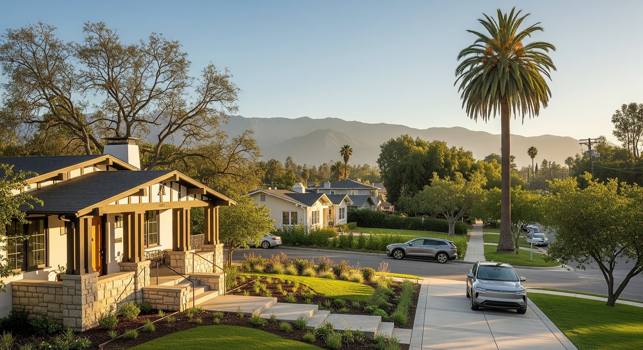
Why Pasadena works
You get a rare blend of transit access, dining and culture, and direct access to parks and open space. Core cultural highlights include the Norton Simon Museum, the Pasadena Playhouse, and the Huntington Library, Art Museum, and Botanical Gardens nearby in San Marino. Outdoor lovers make regular use of the Arroyo Seco and Rose Bowl and Brookside Park, plus trail networks overseen by City of Pasadena Parks and Recreation.
Commute ranges you can expect
Use these representative ranges as you compare neighborhoods. Always confirm for a specific address and time window.
- To DTLA: Drive about 20–45 minutes off‑peak, about 30–60+ minutes at peak. Transit typically about 25–45+ minutes from central Pasadena areas with light rail to Union Station plus a short walk or transfer.
- To Burbank and Media City: Drive about 20–40 minutes off‑peak, about 30–60+ minutes at peak. Transit typically about 30–60+ minutes with transfers.
- To Culver City and the Westside: Drive about 30–50+ minutes off‑peak, about 45–90+ minutes at peak. Transit often 45–90+ minutes with multiple transfers.
Neighborhood snapshots
Below are concise snapshots to help you match lifestyle and commute priorities. For each, you’ll see typical housing, commute ranges, transit access, culture and parks, parking and bikeability, and a quick commuter takeaway. Ranges reflect typical variability rather than guarantees and will change by block.
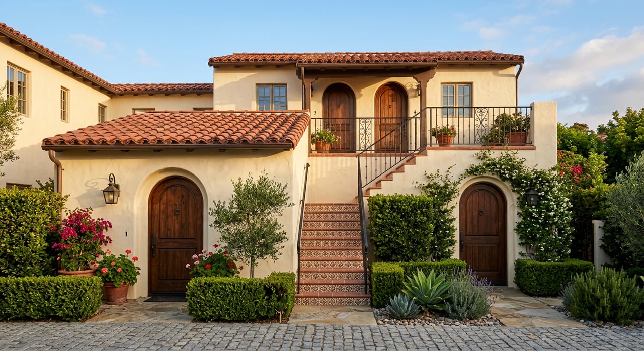
Old Pasadena and Playhouse District
- Housing: Condos, lofts, apartments, and some historic rowhouses in a highly walkable setting.
- Commute ranges:
- DTLA: Drive 20–45 min off‑peak to peak; transit about 25–40+ min with light rail to Union Station plus a short transfer.
- Burbank/Media City: Drive 25–45+ min; transit about 30–60+ min with transfers.
- Culver City/Westside: Drive 30–60+ min; transit about 45–75+ min with transfers.
- Transit and stations: Walkable to Pasadena light rail stations that connect to Union Station and other lines via transfers. Multiple bus options for last mile.
- Culture nearby: Steps to the Pasadena Playhouse and a short hop to the Norton Simon Museum.
- Parks and nature: Quick access to the Arroyo, Brookside, and the Rose Bowl area.
- Parking and bikeability: Street and structure parking varies by block; strong walkability and micromobility.
- Best for: If you want a walkable lifestyle with reliable transit access to DTLA.
South Lake, Prospect, and Annandale
- Housing: Mix of single‑family homes, mid‑century properties, and smaller condos near retail.
- Commute ranges:
- DTLA: Drive 20–40 min; transit about 30–50+ min depending on walking distance to light rail.
- Burbank/Media City: Drive 25–50+ min.
- Culver City/Westside: Drive 35–65+ min.
- Transit and stations: Light rail stations are accessible by a short drive, bike, or longer walk depending on exact address.
- Culture nearby: South Lake Avenue dining and shopping; Caltech events and galleries in easy reach.
- Parks and nature: Quick drive or bike to the Arroyo and Eaton Canyon.
- Parking and bikeability: Generally easier residential parking than the core downtown areas; growing bike corridors.
- Best for: If you want a balanced residential feel with strong retail and manageable commutes in multiple directions.
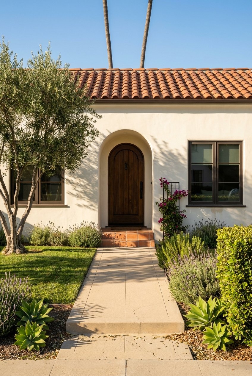
Bungalow Heaven, Madison Heights, and Civic Center Corridor
- Housing: Historic Craftsman bungalows and tree‑lined streets with classic Pasadena character.
- Commute ranges:
- DTLA: Drive 20–45 min; transit about 25–50+ min with a walk to nearby light rail stations.
- Burbank/Media City: Drive 25–50+ min.
- Culver City/Westside: Drive 35–65+ min.
- Transit and stations: Proximity to Pasadena light rail varies by block; bus lines support last mile.
- Culture nearby: Close to the Civic Center, public library, and a short drive to the Norton Simon.
- Parks and nature: Madison Park and Victory Park nearby.
- Parking and bikeability: Residential parking is typically straightforward; calm streets for casual biking.
- Best for: If you value historic architecture and an easygoing residential vibe with access to DTLA by rail or car.
Arroyo, Arroyo Heights, and South Pasadena Border
- Housing: Larger older homes and some hillside properties near the Arroyo Seco.
- Commute ranges:
- DTLA: Drive 20–40+ min, often fastest via CA‑110 off‑peak; limited but usable access to light rail from select spots.
- Burbank/Media City: Drive 25–55+ min.
- Culver City/Westside: Drive 35–70+ min.
- Transit and stations: Rail access may require a short drive and park‑and‑ride. Bus options vary.
- Culture nearby: Quick access to the Norton Simon Museum and the Rose Bowl area.
- Parks and nature: Direct access to the Arroyo Seco, Hahamongna, and foothill trailheads.
- Parking and bikeability: Residential parking is common; strong appeal for runners, cyclists, and hikers.
- Best for: If outdoor access is your priority and you are comfortable driving to rail when needed.
East Pasadena, Hastings Ranch, and Sierra Madre Villa Corridor
- Housing: Older subdivisions and suburban single‑family homes with some more affordable pockets by comparison.
- Commute ranges:
- DTLA: Drive 25–50+ min; transit includes access to eastern light rail stations depending on exact location.
- Burbank/Media City: Drive 25–55+ min.
- Culver City/Westside: Drive 40–75+ min.
- Transit and stations: Light rail stations along the eastern corridor serve many commutes into DTLA.
- Culture nearby: A bit farther from Old Pasadena’s core but with local arts and community centers.
- Parks and nature: Eaton Canyon Natural Area is a standout for hiking and seasonal falls.
- Parking and bikeability: Typically easier residential parking; biking is common for local trips and rail connections.
- Best for: If you prioritize detached housing and are comfortable with longer transit or westbound drives.
Northwest, San Rafael Hills, and San Rafael Park Areas
- Housing: Hillside homes with views, a mix of older and newer construction.
- Commute ranges:
- DTLA: Drive 25–50+ min depending on route and congestion.
- Burbank/Media City: Drive 25–55+ min.
- Culver City/Westside: Drive 35–70+ min.
- Transit and stations: Access to rail varies. Often a short drive to a station for park‑and‑ride.
- Culture nearby: A short drive to Old Pasadena’s museums and venues.
- Parks and nature: Proximity to Hahamongna and foothill trail networks.
- Parking and bikeability: Residential parking is typical; hilly terrain shapes bike routes.
- Best for: If you want scenic separation from busier corridors and will drive most days.
Drive-time and transit-time map layers
When you build or review a Pasadena commute map, include these core layers for reliable decision-making:
- Drive-time isochrones at 15, 30, 45, and 60 minutes for off‑peak and peak. Use a traffic‑aware routing engine and label the date and time tested.
- Transit-time isochrones at 15, 30, 45, and 60 minutes with transfer points and walk times to and from stations. Consult Metro schedules and maps for current service patterns.
- Major transit lines and stations through Pasadena. Include icons for light rail stations and key bus corridors.
- Freeway corridors that affect commutes: I‑210, CA‑110, CA‑134, and connections toward I‑10 and I‑405.
- Employment anchors: DTLA core, Burbank and Media City, Universal City, Culver City, Century City, and Santa Monica. Mark clusters rather than specific private lots.
- Culture and parks: Norton Simon Museum, Pasadena Playhouse, Pasadena Museum of History, Armory Center, Caltech cultural venues, Kidspace, the Huntington, Rose Bowl and Brookside, Arroyo Seco, Eaton Canyon, Hahamongna, Victory Park, and Arlington Garden.
- Park‑and‑ride and station parking markers. For policy and updates, check City of Pasadena Transportation.
Legend guidance: Clarify that times reflect typical conditions. Provide both off‑peak and AM or PM peak overlays. Note the date and time used for estimates.
Test your commute before you buy
A simple test can save you months of frustration:
- Run your exact home-to-office route at your real shift start and end times using Google Maps typical traffic. Save a screenshot.
- Check transit alternatives with Metro’s planner and station info and note transfers and platform-to-office walking time.
- Try a mixed mode: park‑and‑ride to rail for DTLA, or ride‑hail for the final leg on days with meetings.
- Ask your employer about transit subsidies and vanpool programs. Many large organizations offer commuter benefits.
Quick picks by commuting priority
- Best for DTLA rail commuters: Old Pasadena, Playhouse District, and the Civic Center corridor for walkable access to stations and frequent service to Union Station.
- Best for drivers to Burbank and Media City: South Lake, Northwest, and San Rafael areas that connect efficiently to CA‑134 and local surface routes.
- Best for outdoor access with Rose Bowl proximity: Arroyo and Arroyo Heights for direct access to the Arroyo Seco and Brookside trail loops.
- Best for value trade-offs with more space: East Pasadena and Hastings Ranch, recognizing longer westbound drives and varied transit walks.
Practical tips for Pasadena commuters
- Map a 30, 60, and 90‑minute contingency for peak periods so you know your personal tolerance band.
- Keep a flexible plan. On high‑traffic days, rail to DTLA can be more predictable than driving.
- Use park‑and‑ride and station parking judiciously, and review updates on City of Pasadena Transportation.
- Consider bike plus rail for last‑mile connections. Full bike commutes to DTLA or the Westside are uncommon, but bikes excel for station access.
Ready to narrow your short list with data, neighborhood nuance, and on‑the‑ground touring? Reach out to Razmick Ohanian for a tailored relocation plan, live commute checks for specific homes, and private showings that fit your schedule.
FAQs
What are typical rush hour drive times from Pasadena to DTLA?
- Plan for about 30–60+ minutes during peak, with off‑peak often closer to 20–45 minutes depending on your exact starting point and the CA‑110 corridor.
Is transit from Pasadena to Burbank studios practical for daily use?
- It is possible with light rail and bus transfers in about 30–60+ minutes, but many studio employees prefer driving or mixed modes for predictability.
How do Pasadena commutes to the Westside compare with DTLA?
- Westside commutes are generally longer and less direct, with drives commonly 45–90+ minutes at peak and transit requiring multiple transfers.
Which Pasadena areas are closest to light rail stations for DTLA access?
- Old Pasadena, the Playhouse District, and the Civic Center corridor offer the most walkable access to stations that connect to Union Station.
How can I validate commute times for a specific address before making an offer?
- Run a live route at your actual start and end times using Google Maps typical traffic, then cross‑check transfers and schedules on Metro’s site for accuracy.